Study Area
The study area encompasses the Fort Washington Park Greenway along the Henry Hudson Parkway northbound between the George Washington Bridge at the south and Dyckman Street at the north. The study area is bounded to the east by Cabrini Woods and Fort Tryon Park, and to the west by the Henry Hudson Parkway southbound. Notable features within the study area include the pedestrian bridge at W181st Street, Inspiration Point, Billings Arcade, the Henry Hudson Parkway, and the greenway and adjacent retaining wall.

History and Context

1930s wall and greenway – bottom of photo below Castle Village site
Source: Getty Images

Ca 1910 – Lafayette Boulevard – dry stack rubble stone wall with timber guardrail
Source: Museum of the City of New York
The transportation corridor along the study area dates to the late 1800s. Formerly a sidewalk constructed in the 1920’s along Riverside Drive, the existing greenway was constructed in the early 2000s to close a gap in the citywide greenway network. Parks constructed the ADA access ramp from Dyckman Street in 2015. A history of sinkholes has impacted the study area for over 20 years. NYC Parks has addressed these conditions and sinkholes as they have occurred. When NYC Parks identified that an underlying issue with the adjacent retaining wall may be causing recurring sinkholes on the greenway, NYC Parks sought funding for a Capital Project Scope Development (CPSD) study to thoroughly investigate the situation and identify solutions.
Study Scope
The scope of the study is to investigate existing conditions, identify and evaluate feasible options for addressing the issues, and prepare cost estimates. NYC Parks will then use the cost estimates to pursue funding for a capital project to implement a solution.
Study Goals
The goal of the scoping phase is to develop solutions which address the sinkholes and closures, while also considering broader opportunities for improving the safety, functionality, access, capacity, maintenance, and amenities along the greenway. The goals and priorities of the greenway users and local community will inform the solutions identified in the study.
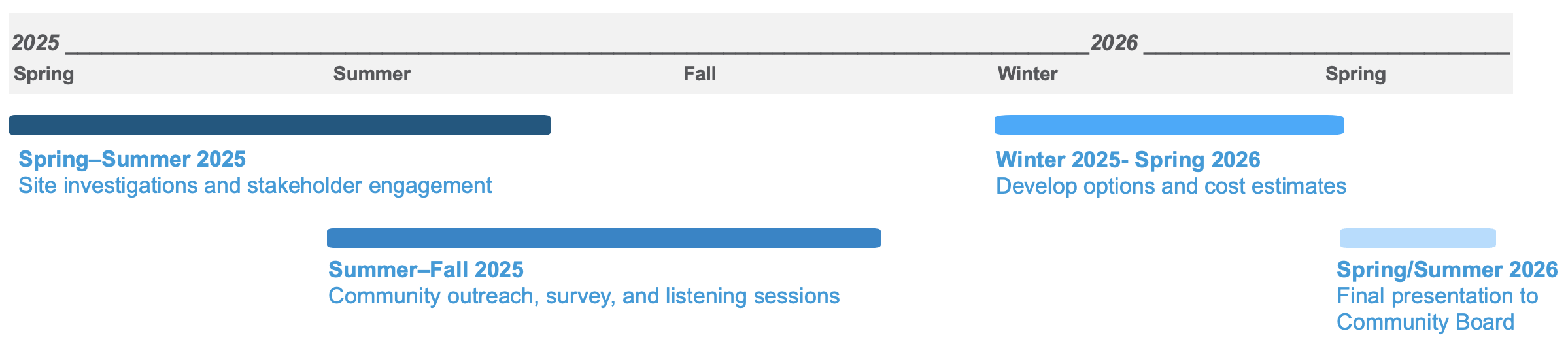
Timeline
The study has a duration of one year. Community engagement will take place from July 2025 to September 2025: